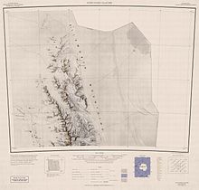
博霍特冰原島峰


坐标:77°23′37″S 85°34′32″W / 77.39361°S 85.57556°W / -77.39361; -85.57556
博霍特冰原島峰是南極洲的冰原島峰,位於埃爾斯沃思地,處於威姆斯山東北面13.7公里、帕斯特羅戈爾峰以東10.93公里、蘭茨峰東南面15.96公里和奧斯特魯沙冰原島峰西北面5.27公里,屬於埃爾斯沃思山脈中森蒂納爾嶺的一部分,海拔高度1,120米,現時由南極條約體系管理。
參考資料
Antarctic Digital Database (ADD). Scale 1:250000 topographic map of Antarctica. Scientific Committee on Antarctic Research (SCAR). Since 1993, regularly upgraded and updated.
Bohot Nunatak. SCAR Composite Gazetteer of Antarctica.
Bulgarian Antarctic Gazetteer. Antarctic Place-names Commission. (details in Bulgarian, basic data in English)
| 这是一篇埃爾斯沃思地地理小作品。你可以通过编辑或修订扩充其内容。 |